
Navionics Navionics+ MSD/NAV+4XG Mexico, Caribbean to Brazil – microSD Format
Original price was: $161.69.$40.42Current price is: $40.42.

Description
Get the world’s Number one choice in marine mapping: with the best, most up-to-date Navionics+ cartography on your compatible chart plotter. For offshore or inland waters, this all-in-one solution offers detail-rich integrated mapping of coastal waters, lakes, rivers and more. Get SonarChart™ 1 Feet HD bathymetry maps, advanced features such as dock-to-dock route guidance technology , live mapping and Plotter Sync to provide wireless access to daily updates. The Navionics Chart Installer software also ensures the freshest chart data every time out. Navionics dock-to-dock route guidance solutions give you a suggested path to follow through channels, inlets, marina entrances and more. Multiple shading options aid in shallow water navigation and make it easy to highlight a target depth range for the best fishing spots. Coastal coverage of Mexico, Central America and Brazil. Coverage features the US Gulf Coast and the eastern US coast to Savannah, GA; Bermuda; the Bahamas; Cuba; Hispaniola; Puerto Rico and the Virgin Islands; the Windward and Leeward Islands; Jamaica; the Panama Canal, the western coast of South America to Arica, Chile; the Galapagos Islands; the Revillagigedo Islands; the Ilha Fernando de Noronha; the Saint Peter and Saint Paul Archipelago and the Rocas Atoll.
Navionics 010C136430 Attributes
- Compatibility: Chart Plotters
- Chart Coverage: Detailed Coverage Of Coastal Of Mexico/ Central America And Brazil
- Storage: On SD/ Micro-SD Card
Navionics 010C136430 Features & Benefits
- Integrated Garmin And Navionics Content Provides Exceptional Coverage, Clarity And Detail In A Familiar Look And Fee
- Easy Access To Daily Chart Updates Is Available Via The Navionics Chart Installer Software Or Wirelessly Via The Plotter Sync Feature With The Navionics Boating App
- Navionics Advanced Dock-To-Dock Route Guidance Technology Uses Your Boat Settings, Along With Chart Data And Frequently Traveled Routes, To Calculate A Suggested Path To Follow
- Download The Community Edits Content Layer To Any Navionics Card, And View This Valuable, Local Information: Contributed By Navionics Boating App Users: On Your Compatible Chart plotter
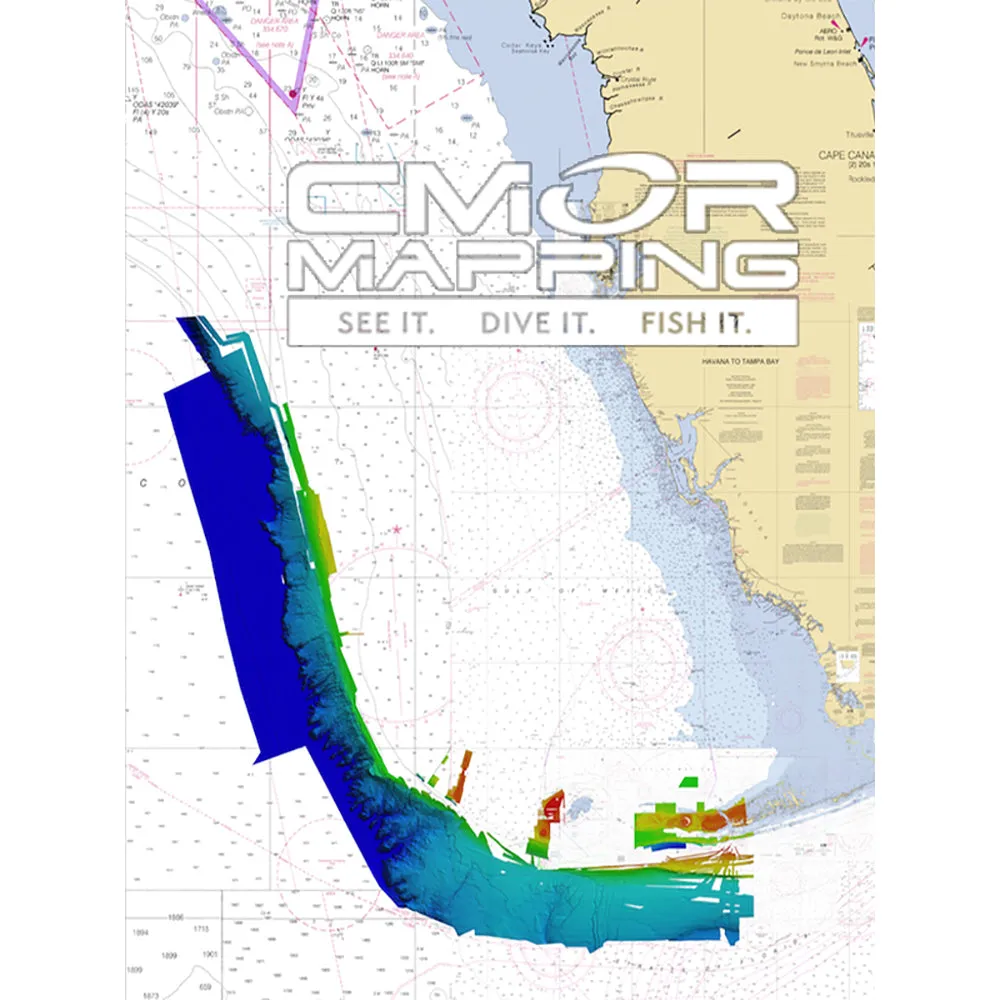
- For Improved Fishing And Navigation, SonarChart HD Bathymetry Maps Display Up To 1 Feet Contours, Providing A More Detailed Depiction Of Bottom Structure
- Fishing Range Advanced Feature Lets You Highlight A User-Defined Target Depth Range
- To Aid In Navigation, The Shallow Water Shading Advanced Feature Highlights Depths Up To A User-Defined Level
- SonarChart™ Live Mapping Feature Allows Boaters To Create New Personal 1 Feet HD Bathymetry Maps That Display In Real Time On The Screens Of Their Compatible Plotters While Navigating
- Limited 2 Year Warranty
Navionics 010C136430 Technical Bulletins
- NAV010-C1370-40br.pdf
Navionics+ MSD/NAV+4XG Navionics+ Chart – Mexico, Caribbean to Brazil – microSD Format
All-in-one max detailed cartography for marine and lakes makes Navionics+ the perfect choice for cruising, fishing and sailing. Get the most accurate navigational data for your GPS plotter, an exclusive 1 ft HD bathymetry map which is enhanced by boaters like you, and unique local content shared by Navionics app users. We make thousands of edits every day, so you can always have the most current charts. Daily updates and advanced features are included for one year.
Advanced Features:
- Dock-to-dock Autourouting – start your trip with a suggested route
- SonarChart™ Live – create your own maps
- Advanced Map Options – customize your view
- Plotter Sync – plan on mobile, go on plotter
It’s safer to ride a boat, to fish smarter, and make the most of your time on the water! Navionics+ is an all-in-one maximum detailed mapping technology for oceans and lakes, and is ideal for Navionics+.!!!!—-
PRODUCT ID: 81119
SKU: NVN-81119
CSKU: CWR-81119
REWRITE: 92230-navionics-navionics-msd-nav-4xg-mexico-caribbean-to-brazil
MPN: MSD/NAV+4XG
UPC: 821245990464
ASIN: B08HDFYTQG
WSKU:
SSKU: NAV-MSD/NAV4XG
KSKU: NAV010C136430
GSKU:
MSKU:
LSKU:
NAME: Navionics Navionics+ MSD/NAV+4XG Mexico, Caribbean to Brazil – microSD Format
NAME_EX: NAVIONICS MEXICO CARIBBEAN TOBRAZIL MSD FORMAT NAVIONICS+
PTITLE: Navionics Navionics+ MSD/NAV+4XG Mexico, Caribbean to Brazil – microSD Format
TYPE: Cartography | Navionics +
VENDOR: Navionics
Google Category: SOFTWARE > COMPUTER SOFTWARE > GPS MAP DATA & SOFTWARE
Amazon Category:
Amazon Title: Navionics Navionics+ MSD/NAV+4XG Mexico, Caribbean to Brazil – microSD Format
Google Title: MSD/NAV+W Navionics+ World microSD Media Card | For Marine Navigation
Amazon Category:
Gtags:
GSpecs: