
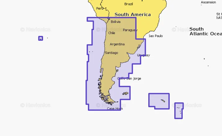
Navionics+ NASA005L Chile, Argentina & Easter Island
Original price was: $161.59.$40.40Current price is: $40.40.

Description
Get the world’s Number one choice in marine mapping: with the best, most up-to-date Navionics+ cartography on your compatible chart plotter. For offshore or inland waters, this all-in-one solution offers detail-rich integrated mapping of coastal waters, lakes, rivers and more. Get SonarChart™ 1 Feet HD bathymetry maps, advanced features such as dock-to-dock route guidance technology , live mapping and Plotter Sync to provide wireless access to daily updates. The Navionics Chart Installer software also ensures the freshest chart data every time out. Navionics dock-to-dock route guidance solutions give you a suggested path to follow through channels, inlets, marina entrances and more. Multiple shading options aid in shallow water navigation and make it easy to highlight a target depth range for the best fishing spots. Coastal coverage of South America from Arica, Chile to Rio Grande, Brazil. Coverage features Easter Island, Cape Horn, the Falkland Islands/Islas Malvinas, the South Georgia Islands, the South Sandwich Islands and the Rio de la Plata.
Navionics 010C136530 Attributes
- Compatibility: Chart Plotters
- Chart Coverage: Detailed Coverage Of South America From Arica/ Chile To Rio Grande/ Brazil
- Storage: On SD/ Micro-SD Card
Navionics 010C136530 Features & Benefits
- Integrated Garmin And Navionics Content Provides Exceptional Coverage, Clarity And Detail In A Familiar Look And Fee
- Easy Access To Daily Chart Updates Is Available Via The Navionics Chart Installer Software Or Wirelessly Via The Plotter Sync Feature With The Navionics Boating App
- Navionics Advanced Dock-To-Dock Route Guidance Technology Uses Your Boat Settings, Along With Chart Data And Frequently Traveled Routes, To Calculate A Suggested Path To Follow
- Download The Community Edits Content Layer To Any Navionics Card, And View This Valuable, Local Information: Contributed By Navionics Boating App Users: On Your Compatible Chart plotter
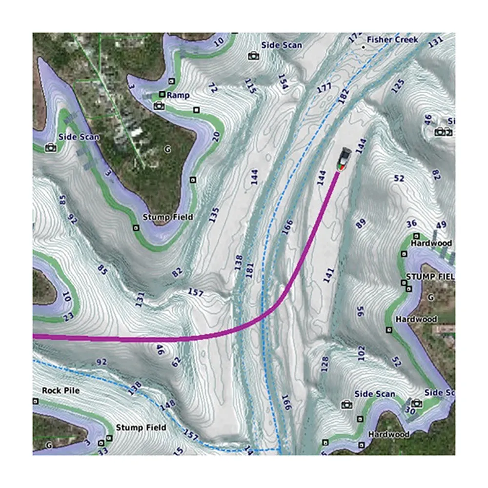
- For Improved Fishing And Navigation, SonarChart HD Bathymetry Maps Display Up To 1 Feet Contours, Providing A More Detailed Depiction Of Bottom Structure
- Fishing Range Advanced Feature Lets You Highlight A User-Defined Target Depth Range
- To Aid In Navigation, The Shallow Water Shading Advanced Feature Highlights Depths Up To A User-Defined Level
- SonarChart™ Live Mapping Feature Allows Boaters To Create New Personal 1 Feet HD Bathymetry Maps That Display In Real Time On The Screens Of Their Compatible Plotters While Navigating
- Limited 2 Year Warranty
Navionics 010C136530 Technical Bulletins
- NAV010-C1370-40br.pdf
NASA005L Chile, Argentina & Easter Island – MicroSD Card
Coastal coverage of South America from Arica, Chile to Rio Grande, Brazil. Coverage includes Easter Island, Cape Horn, the Falkland Islands/Islas Malvinas, the South Georgia Islands, the South Sandwich Islands, and the Rio de la Plata.
Get the world’s No. 1 choice in marine mapping — with the best, most up-to-date Navionics®+ cartography on your compatible chartplotter. For offshore or inland waters, this all-in-one solution offers detail-rich integrated mapping of coastal waters, lakes, rivers, and more. Get SonarChart™ 1’ (0.5 meters) HD bathymetry maps, advanced features such as dock-to-dock route guidance technology (depending on chartplotter model), live mapping, and Plotter Sync to provide wireless access to daily updates. The Navionics® Chart Installer software also ensures the freshest chart data every time out. Navionics route guidance solutions give you a suggested dock-to-dock path to follow through channels, inlets, marina entrances, and more. (Route guidance is for planning purposes only and does not replace safe navigation operations.) Multiple shading options aid in shallow water navigation and make it easy to highlight a target depth range for the best fishing spots.
Features:
- Integrated Garmin and Navionics® content provides exceptional coverage, clarity, and detail in a familiar look and feel
- Easy access to daily chart updates is available via the Navionics® Chart Installer software or wirelessly via the Plotter Sync feature with the Navionics Boating app (The Plotter Sync feature requires the use of the Navionics Boating app on your compatible smart device with an active subscription of the same area.)
- Navionics® advanced dock-to dock route guidance technology uses your boat settings, along with chart data and frequently traveled routes, to calculate a suggested path to follow (Route guidance is for planning purposes only and does not replace safe navigation operations.)
- Download the Community Edits content layer to any Navionics® card, and view this valuable, local information — contributed by Navionics Boating app users — on your compatible chartplotter
- For improved fishing and navigation, SonarChart™ HD bathymetry maps display up to 1’ (0.5 meter) contours, providing a more detailed depiction of bottom structure
- Fishing range advanced feature lets you highlight a user-defined target depth range
- To aid in navigation, the shallow water shading advanced feature highlights depths up to a user-defined level
- SonarChart™ Live mapping feature allows boaters to create new personal 1’ HD bathymetry maps that display in real time on the screens of their compatible plotters while navigating
- Worldwide coverage available
- Available on microSD™ cards; cartography updates are available via annual renewable subscription (the first year of updates is included)”
**NOT FOR USE IN GARMIN CHARTPLOTTERS**
!!!!—-
PRODUCT ID: 92604
SKU: NVN-92604
CSKU: CWR-92604
REWRITE: 103715-navionics-nasa005l-chile-argentina-easter-island
MPN: 010-C1365-30
UPC: 821245990471
ASIN:
WSKU:
SSKU:
KSKU: NAV010C136530
GSKU:
MSKU:
LSKU:
NAME: Navionics+ NASA005L Chile, Argentina & Easter Island
NAME_EX: NAVIONICS NASA005L CHILE ARGENTINA & EASTER ISLAND
PTITLE: Navionics+ NASA005L Chile, Argentina & Easter Island
TYPE: Cartography | Navionics +
VENDOR: Navionics
Google Category: SOFTWARE > COMPUTER SOFTWARE > GPS MAP DATA & SOFTWARE
Amazon Category:
Amazon Title:
Google Title:
Amazon Category:
Gtags:
GSpecs: