
C-MAP Reveal Port St Lucie to New Orleans #M-NA-Y644-MS
Original price was: $330.32.$66.06Current price is: $66.06.

Description
C-MAP USA M-NA-Y644-MS Electronic Charts
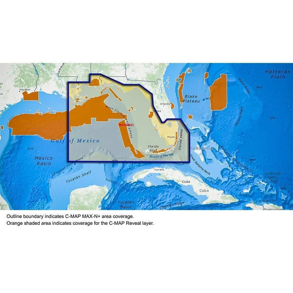
Reveal – US – Port St. Lucie to New Orleans St. Lucie Inlet FL to New Orleans LA
Perfect for fishing and diving enthusiasts, C-MAP® Reveal charts deliver ultra, high-resolution images of structure, wrecks, isolated reefs and ledges on the sea floor, plus full navigation capability – all at a more affordable price than other charts in its category.
Features:
- High-definition C-MAP Reveal layer for selected coastal and offshore areas
- Reduces search time with immediate high-definition display of bottom structure, wrecks, isolated reefs and ledges
- 11 local charts for U.S. coastal area
- C-MAP Reveal maps available on SD card
- Easy to use – simply turn on Shaded Relief setting in chartplotter
- C-MAP Reveal charts contain full C-MAP MAX-N+ vector navigation data, including new features like High Res Bathy, Custom Depth Shading, Genesis layer and satellite imagery
- Includes detailed marina and port plans
Normalized SKU: MNAY644MS
UPC Code: 9420064111381