
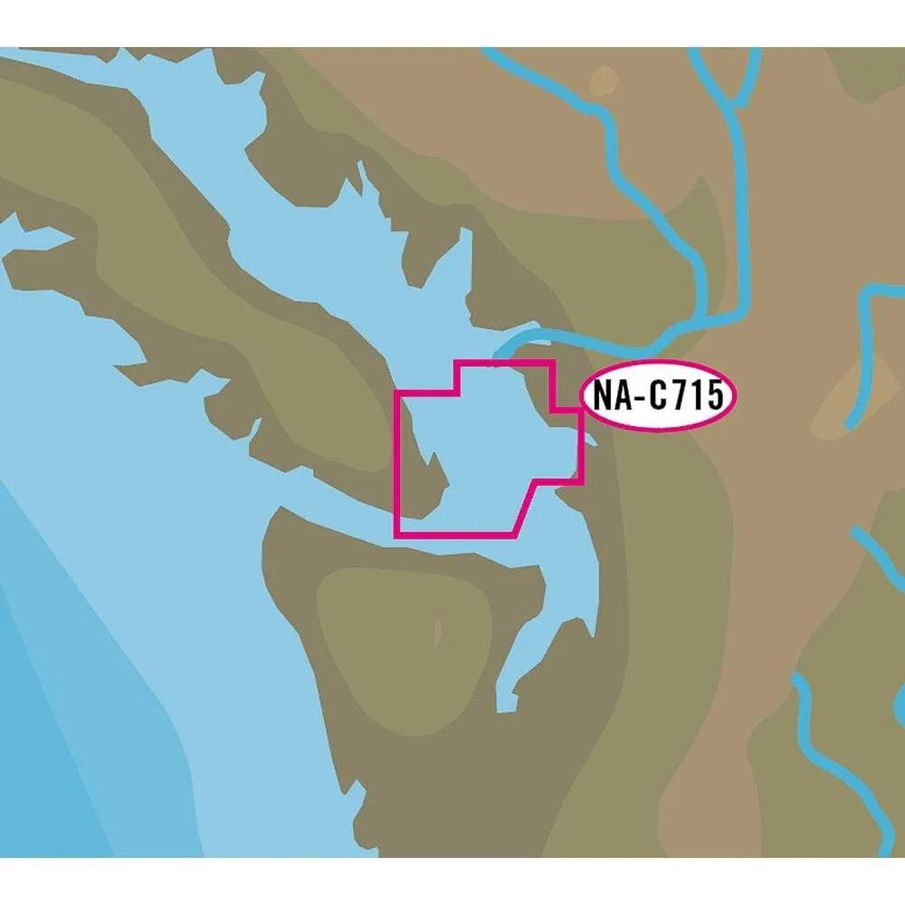
C-Map Nt+ NA-C715 FP Format San Juan Islands #NA-C715FPCARD
Original price was: $284.29.$71.07Current price is: $71.07.

Description
C-MAP USA NA-C715FPCARD Electronic Charts
NT+ NA-C715 FP Format – San Juan Islands
C-MAP NT+ cartography helped launch a digital charting revolution years ago, and it is still as useful and reliable as ever. For fishermen, sailors and cruisers who continue to depend on C-MAP NT+, C-Map provides updates twice annually to ensure that navigators benefit from all the latest Coast Guard Notice to Mariner (NTM) changes and other important chart data updates.
- Rich chart detail and available data to aid in safe navigation
- Easy on-screen queries of chart objects for greater situational awareness
- Compatible with many brands and models of chartplotters on the water
- Local and Wide coverage areas available
Features:
- C-MAP NT+ provides boaters with the accurate, up-to-date vector chart detail including Depth Areas and Contours, Spot Soundings, NavAids, Light Sectors, Wrecks/Obstructions, Small Craft Facilities and more.
- The detail and information available with C-MAP NT+ charts lets boaters approach any harbor and inlet with confidence — the perfect conclusion to a long voyage, sailing adventure or exciting day of bluewater fishing.
- C-MAP NT+ Tides feature presents the time, water level and direction of tides with Tide Level graphs. This information is vital for navigation and fishing.
- C-Marina Port database and detailed marina charts in C-MAP NT+ provides useful, categorized information for cruisers, fishermen and sailors — including Port Layout and Facilities, Operating Hours, Accessibility, phone/Email Contact Info and more.
Additional Features:
- Global Coverage
- Rich chart detail and available data to aid in safe navigation
- Port & Tide Information
- Frequently updated chart data
- Easy on-screen queries of chart objects for greater situational awareness
- Compatible with many brands and models of chartplotters on the water
- Compatible with PC Planner
Specifications:
Card Format = NONE
Normalized SKU: NAC715FPCARD