C-MAP MAX NA-M026 – Great Lakes & The Maritimes – SD™ Card
Original price was: $279.00.$69.75Current price is: $69.75.

Description
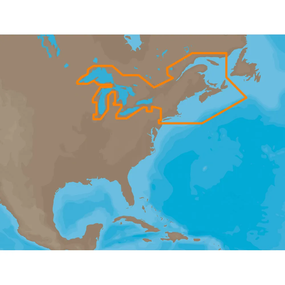
NA-M026 => Great Lakes, Northeast Coast and Approaches
Coverage of the Great Lakes, St. Lawrence River and Northeast United States.Coverage of the Great Lakes also includes Fox River and Lake Winnebago, Lake St. Clair, Rideau Canal, Ottawa River and the Trent-Severn Waterway.Includes all coastal charts for New Brunswick and Nova Scotia in Canada and Maine, New Hampshire, Massachusetts, Connecticut and New York in the U.S.Also included is coverage of the Hudson River and Lake Champlain as well as the Erie Barge Canal.This product may not be returned to the original point of purchase.Please contact the manufacturer directly with any issues or concerns.
Dryer connector To reduce the space between the dryer and the wall or solve the problem of narrow ventilation, please use this refractory 4 “” “” dryer offset connector of deflect-o. It provides…!!!!—-
PRODUCT ID: 30143
SKU: NVN-30143
CSKU: CWR-30143
REWRITE: 41254-c-map-max-na-m026-great-lakes
MPN: NA-M026SDCARD
UPC:
ASIN:
WSKU:
SSKU:
KSKU:
GSKU:
MSKU:
LSKU:
NAME: C-MAP MAX NA-M026 – Great Lakes & The Maritimes – SD™ Card
NAME_EX: C-MAP NA-M026 SD CARD FORMAT GREAT LAKES AND MARITIMES
PTITLE: C-MAP MAX NA-M026 – Great Lakes & The Maritimes – SD™ Card
TYPE: Cartography | C-Map Max
VENDOR: C-MAP
Google Category: SOFTWARE > COMPUTER SOFTWARE > REFERENCE SOFTWARE > GPS MAP DATA & SOFTWARE
Amazon Category:
Amazon Title:
Google Title: C-MAP MAX Wide NA-M026 Great Lakes on SD
Amazon Category:
Gtags:
GSpecs: