
Description
Download Literature
Watch Video
C-MAP USA NA-M028C-CARD Electronic Charts
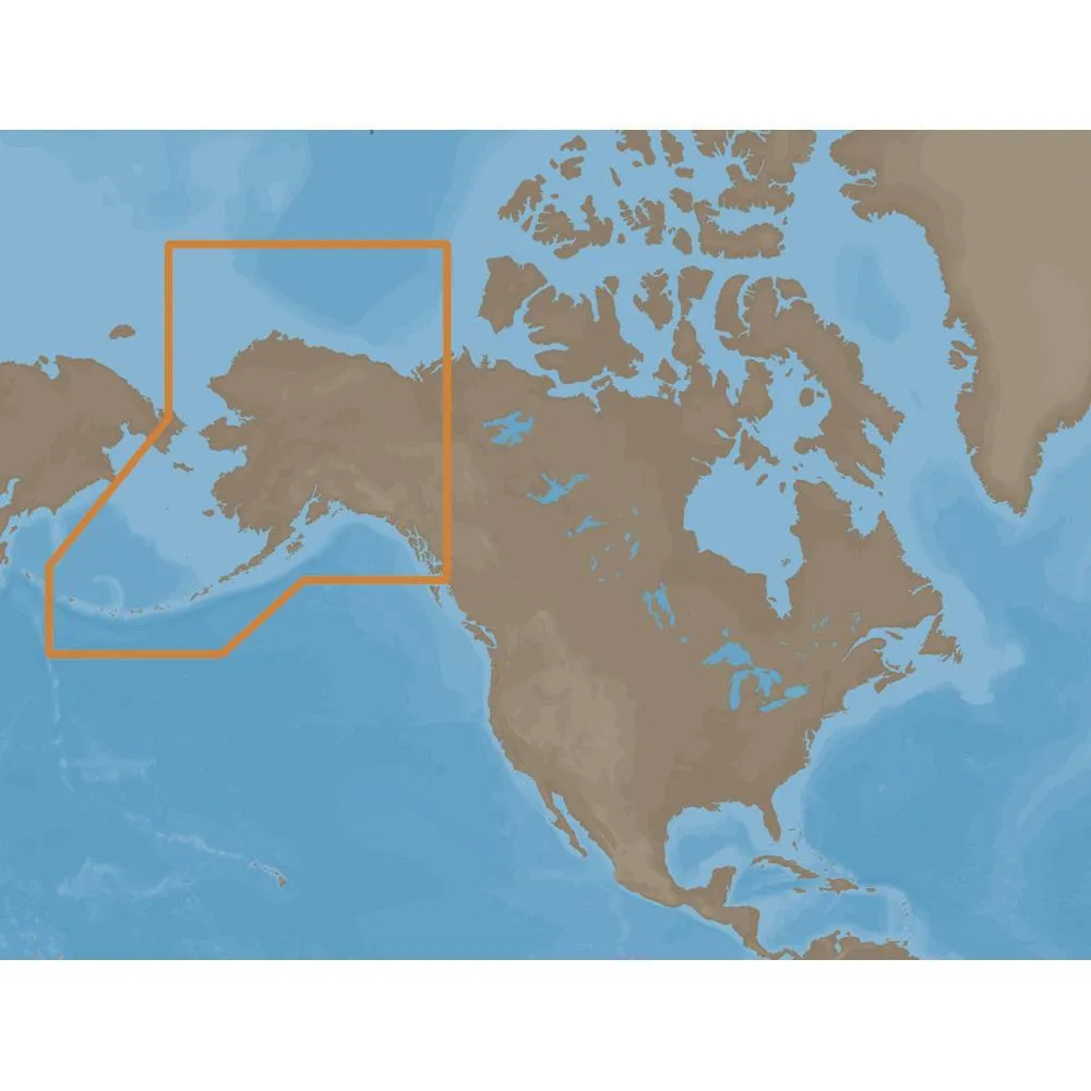
NA-M028 => Alaska
Coverage of the southern Alaska coast from Dixon Entrance up and over to Kodiak Island.Includes all of the Aleutian Islands out to Attu Island, Bristol Bay, and the North Slope over to Liverpool Bay in the Yukon Territory, Canada.Additional coverage of the MacKenzie River down to the 1160 km distance marker.
Specifications:
3-D View = Yes
Aerial Photos = Yes
Port Plans = Yes
Card Format = NONE
C-MAP NA-M028 C-CARD FORMAT ALASKA
Normalized SKU: NAM028CCARD
UPC Code: 686074002838
C-MAP USA NA-M028C-CARD Literature Download
Quick Reference Guide